Is it possible to successfully combine traditional ground-based survey techniques with drone data in order to save time and money? We work with Stover School to explore the possibilities.
OUTCOMES
- Project saved money by combining drone and traditional survey data
- Cloud-based drone outputs could be easily shared with school and architects
- Rapid data capture shortened the project timeline
- Enabled detailed maps and survey data at a lower cost for the end-user
THEIR CHALLENGE
Using a combination of drone data and ground-based survey information to produce a high quality topo survey map
In some situations, it is beneficial to combine the data from traditional ground-based "stake-out" surveys with drone data, especially over large and complex sites where both accessibility and scale is a challenge. We worked alongside South West Topographic Surveys to create an accurate orthomosaic and measured building survey for Stover school as part of an initial planning application survey.
Drone to CAD conversion process
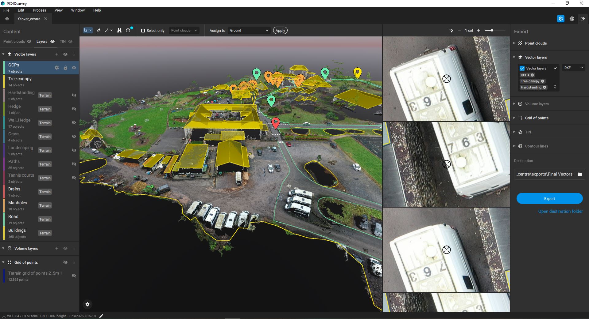
Our software allows us to convert our point-cloud and photogrammetric data into simplified outputs ready for CAD. This process involves manually outlining the footprints of buildings, roads, trees and other objects and then converting them into 3D dxf files that can be incorporated into a range of desktop CAD software. This process of vectorisation allows different data to be assigned into layers and therefore simplifies and streamlines the workflow and saves processing time.
ABOUT STOVER SCHOOL
Stover School is a leading independent school on the edge of Dartmoor
Stover prides itself on teaching children about the value of moral standards and good standards of behaviour. They offer a broad and balanced curriculum that recognises natural talents and nurtures the individual. As a relatively small school they know every pupil very well; their needs, how they learn, and these strong relationships, which develop as they grow.
Why South West Aerial Surveys?
- Licenced and audited by the CAA with £5million public liability insurance
- The latest enterprise-level technology using a range of sensor technologies: visual, thermal and mapping as well as ground-based 3D scanning and digitisation
- Staff and equipment resource capability to deliver large and small projects, both in the SW and further afield
- Problem-solving attitude with a track record of safe and efficient delivery in a range of sectors for different clients


