Topographic surveys, orthomosaics, DSMs and DTMs

We use the latest photogrammetry techniques to rapidly process UAV captured data

Drone in sky

A range of applications

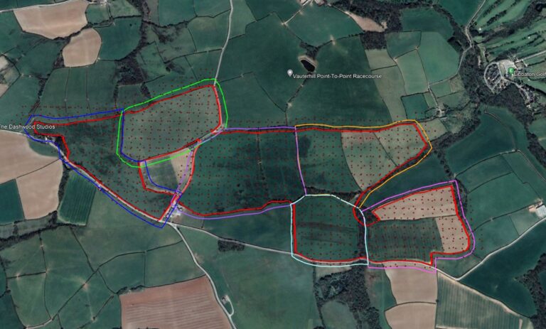
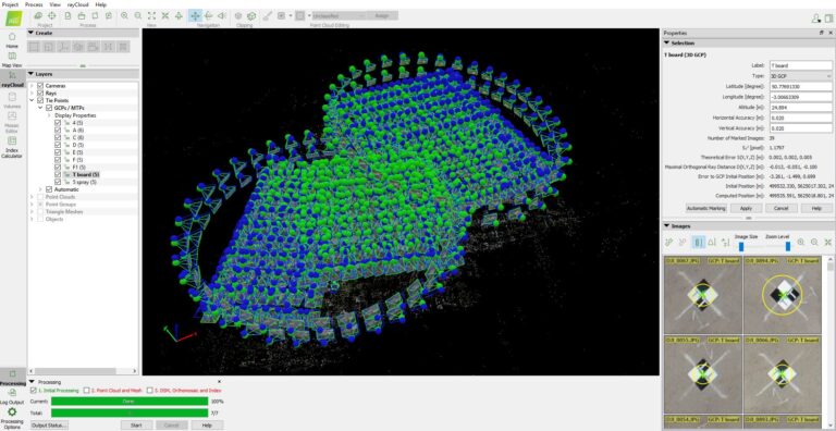
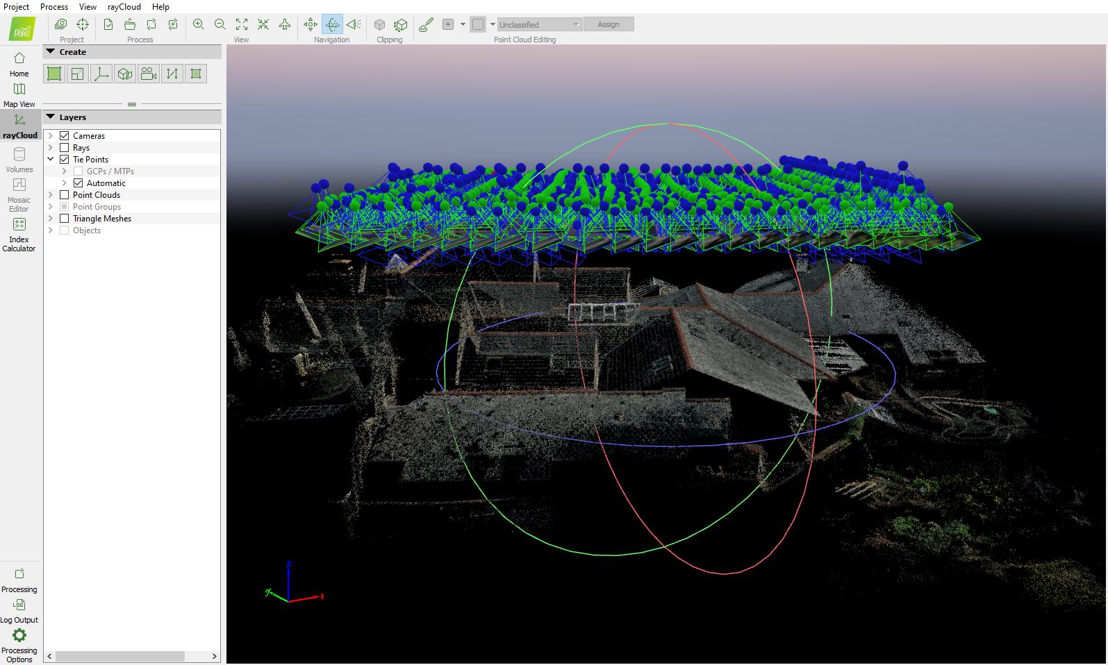
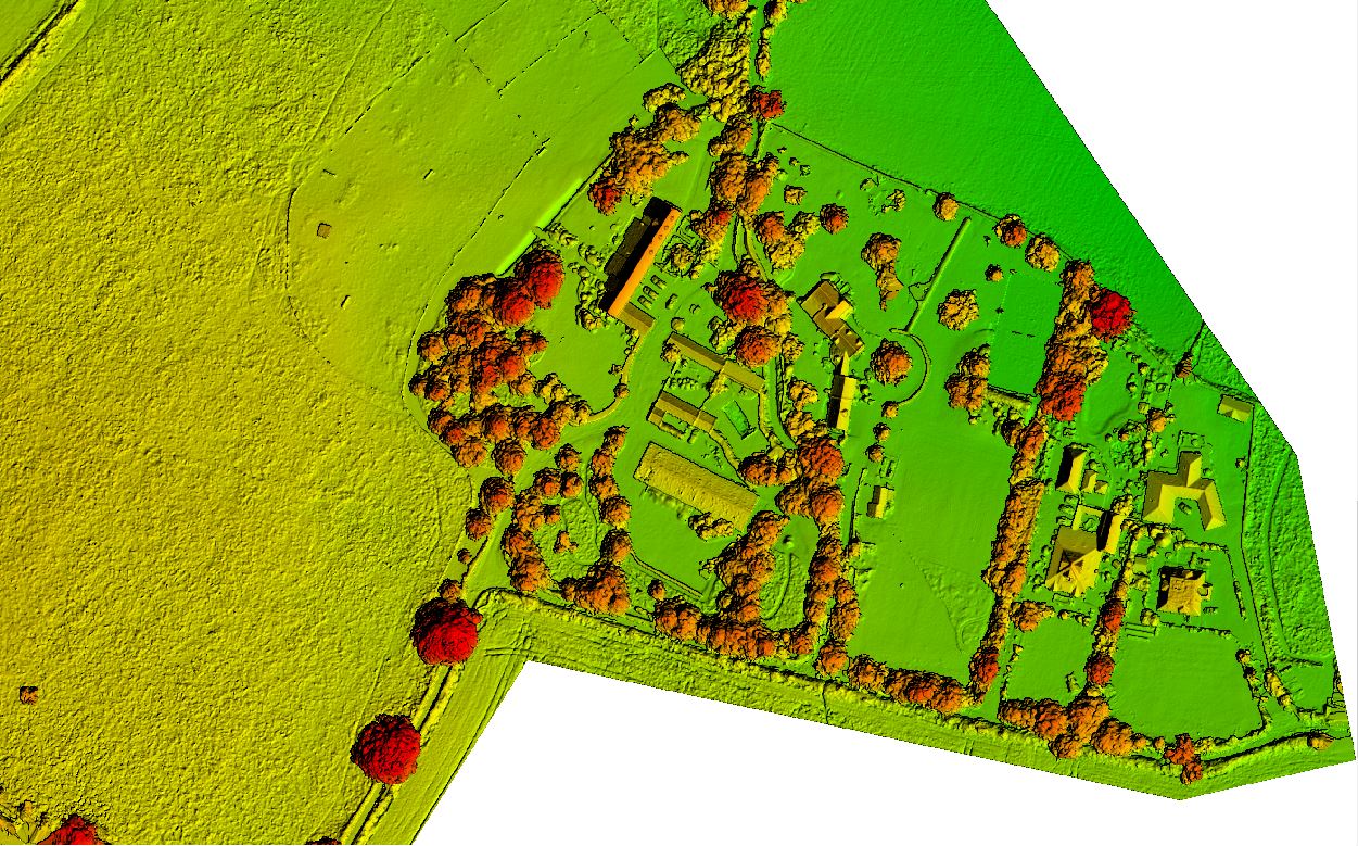
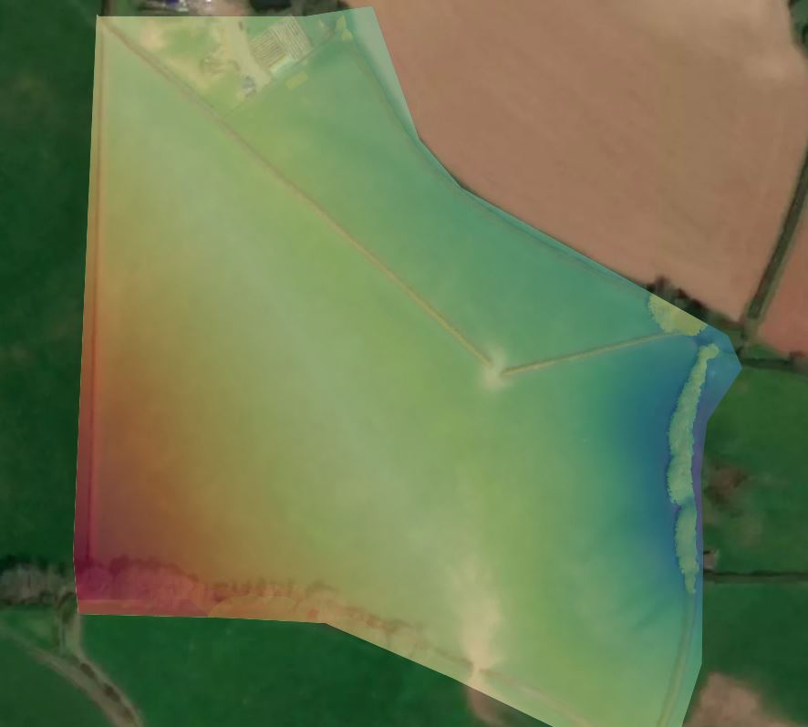
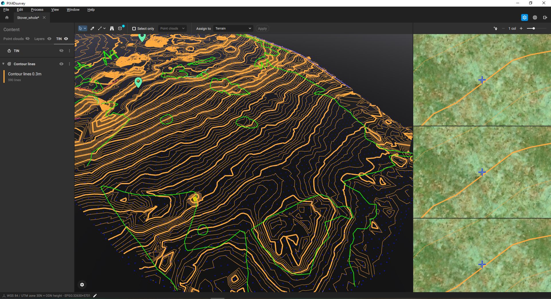
UAVs offer a data workflow that can be used by a wide range of industries and sectors

Our outputs have a number of use cases including tracking site and building progress, cut and fill (volumetric) calculations as well as a range of dimensionally accurate maps.  We work for a range clients who are looking to survey large sites,  those planning to develop new housing and infrastructure as well as those who simply want a point-cloud digital twin of their asset.

Accurate data capature

Expected outcomes are cm accurate when using Ground Control Points (GCPs)

You can expect precise mapping using accurate survey techniques with RTK GNSS and NTRIP correction.  We use meticulous flight planning and sophisticated software to automate our UAV flights, minimising human error. This gives measurable results to RICs Survey grade D or E, even on large projects of 100+ Ha

Rapid turnaround

Our software allows for powerful and fast local or cloud-based processing

Using UAVs for data capture gives fast turnaround times compared to traditional mapping techniques and the first phase of deliverables are usually ready 24 hrs after the initial flight.

Drone survey1

Deliverables and outputs

UAVs offer a number of benefits to traditional topographic mapping

Increased team safety

By entrusting the bulk data capture of a topographic survey to a UAV, surveyors no longer have to manually collect data in areas where the terrain or surrounding environment is dangerous. This makes the overall process far safer and keeps field professionals productive and safe on the ground.

Reduce overall survey time

Using a UAV, topographic surveyors can get an aerial view of the land they are surveying. UAVs, equipped with the right software and  sensors can be used to greatly reduce the time needed to deliver highly accurate topographic survey mapping.   Up to 100 ha can be surveyed in 1 working day.  

Quickly verify accuracy

Ground control points (GCPs) with RTK / GNSS are crucial for ensuring the accuracy of a drone-led topographic survey. Using specialist software, our workflow links data capture, GCPs with accurately geolocated orthophotos and point clouds.  We even include data check-points to demonstrate accuracy. 

Why South West Aerial Surveys?

Scroll to Top