External Digital Twins and outputs to CAD
We offer an end-to-end service - data capture and processing from CAD through to GIS.

As built, external digital twins
An accurate and measurable digital copy of your asset
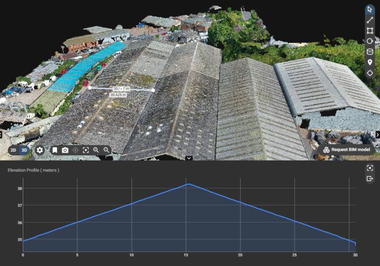
Aerial surveys make perfect commercial sense for capturing a measurable digital twin of your asset. This could include large houses, factories, churches, hospitals, heritage buildings, schools and universities. Including buildings, landscape and terrain. Our UAV fleet collect precision data combined with accurate GNSS survey tools to create 2D and 3D models.
Our always-on online cloud platform allows these to be cloud hosted and measurable in 2 and 3D.
CAD vectorisation
Bridging the gap between photogrammetry and CAD
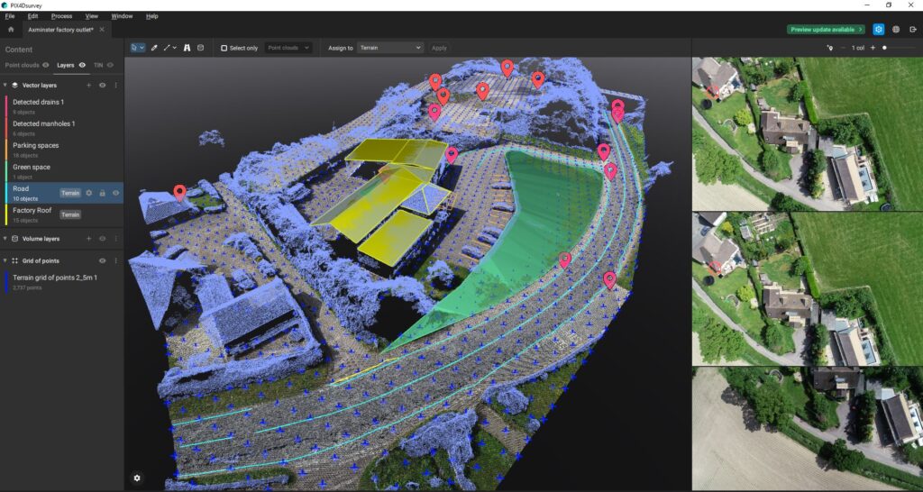
We work with complex UAV data and make it CAD-ready. We can provide a number of deliverables including:
- vectors as dxf files (buildings footprints, roofs, kerbs, walls, roads etc - both polylines and polygons)
- grid of points / TIN models (simplfying the often large point-cloud data)
- terrain classification and contour lines


GIS outputs
Bespoke outputs and deliverables
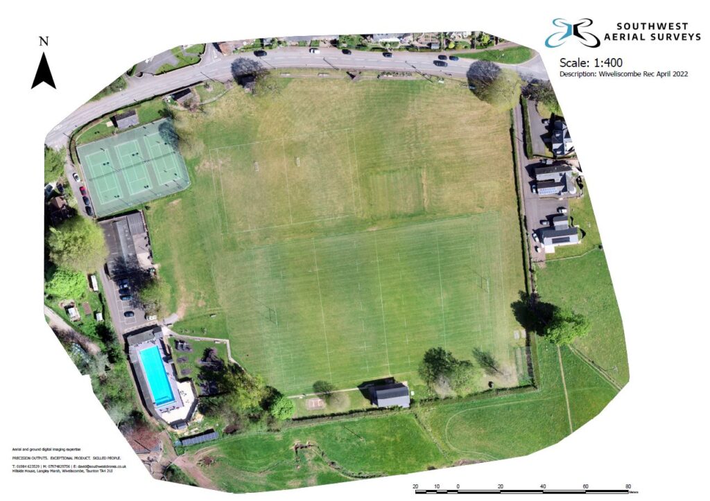
We also use GIS in-house to produce different types of customised and scales printed maps (e.g. othomosaics with or without contours, DTMs, DSMs etc). These can be used as boundary documents or to support planning applications, or simply to share with relevant stakeholders. These "lightweight" documents are both accurate and visual allowing your story to be simply and easily told.
Always on demand
Easy-to-use cloud hosted data and models
Our always-on cloud based hosting is available which means that a range of outputs can be simply and easily shared with different teams and clients. You can for example, modify maps and measure distances, or calculate terrain and cut and fill volumes. All from your desktop, tablet or mobile with no specialist software to install.
Why South West Aerial Surveys?
- Licenced and audited by the CAA with £5million public liability insurance
- The latest enterprise-level technology using a range of sensor technologies: visual, thermal and mapping as well as ground-based 3D scanning and digitisation
- Staff and equipment resource capability to deliver large and small projects, both in the SW and further afield
- Problem-solving attitude with a track record of safe and efficient delivery in a range of sectors for different clients
