
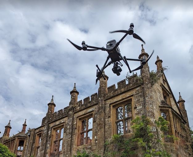
Mann Williams needed to get an accurate set of BIM plans for the remaining structure but access into the damaged parts was not safe for a traditional ground survey. We used an enterprise level drone (DJI M300) with 40MP mapping camera and high accuracy GNSS GPS to create a point cloud and digital model hosted online. This allowed different stakeholders to access quantitative information remotely and to make decisions without having to visit the site. It was also much safer since the building had was unstable and could not be accessed.

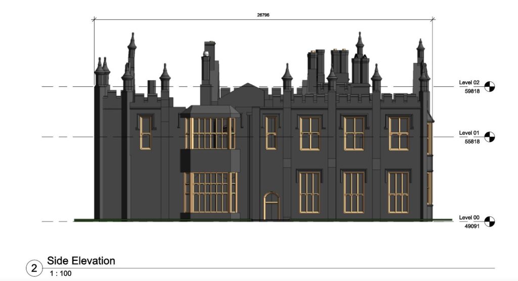
Part of the requirement for the project was to work with Purcell's in Bristol. They are specialist architects and heritage consultants. Purcell's had requested Level 4 records, combined with raw images that could be set up on drawing sheets for issue to Historic England prior to commencement of the restorative works. We worked with Pix4D to produce BIM files and .rcp ready for AutoCAD to pass on directly to the client.
Formed in 1986, Mann Williams work across a wide portfolio of projects throughout the UK and Europe, covering all sectors of the built environment. Their diverse experience equips them to work on both new build and conservation projects, with a proven track record of delivering new construction in historic and re-use environments.