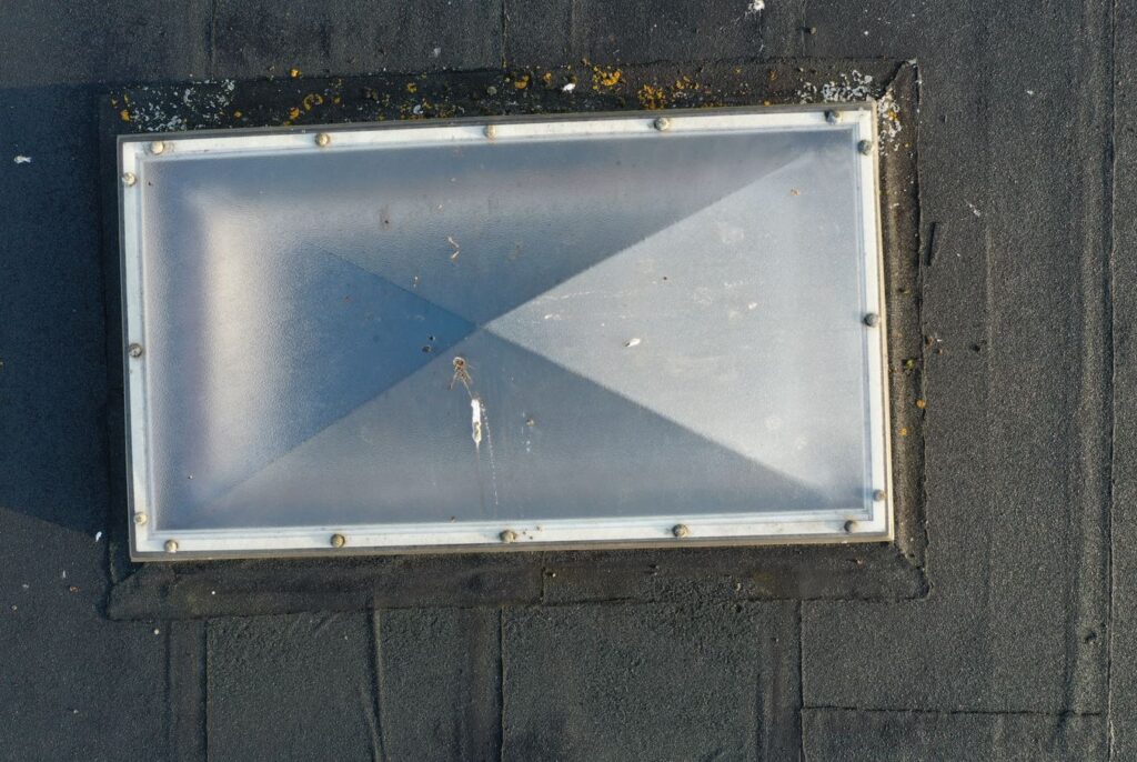
CS2 needed high-quality roof images to conduct a remote roof condition survey. Offering a safer, quicker and cheaper workflow with our enterprise-level drone technology we helped out....
OUTCOMES
- Saved time + money by using remote assessment and not having to send a surveyor
- Fixed the communication and information gaps for remote assessment
- Our 24hr turnaround of outputs meant that data could be quickly analysed
- Enabled the creation of a detailed, evidenced client report at a lower cost
THEIR CHALLENGE
Lower-cost, high quality and safe roof inspection
Inaccessible roof inspection, especially in commercial and busy town and city centres can be challenging. Traditional techniques using cherry pickers is complex and costly when compared to drone imagery. We were chosen to work with CS2 since we have substantial experience in de-risking our operations through our bespoke flight planning systems and our extensive flying hours. We also carry £5 million public legibility insurance and have a team of commercial drone pilots working under our Operational Authorisation which is regulated and annually audited by the CAA.
Getting close-up with remote inspection
Our drone technology is enterprise level which enables us to work in a wider range of more complex environments, whilst still being able to get the highest-quality and highest resolution images. In fact its as good as being there. This means that we were able to operate independently without having to have a member of the CS2 team on site. Instead, we simply captured the data and the sent the images, securely and geolocated, immediately after the agreed flight. CS2 was able to save on sending out a surveyor to site and also pass on cost savings directly to the client
ABOUT CS2
Building Surveying and Cost Consultancy Experts
CS2 provides a full range of professional, multi-discipline property and construction consultancy services for all market sectors, across the UK and around the world. ⯈ Construction Consultancy ⯈ Building Surveying ⯈ Dilapidations ⯈ Cost Consultancy ⯈ Energy and Sustainability ⯈ Insurance Surveying
Why South West Aerial Surveys?
- Licenced and audited by the CAA with £5million public liability insurance
- The latest enterprise-level technology using a range of sensor technologies: visual, thermal and mapping as well as ground-based 3D scanning and digitisation
- Staff and equipment resource capability to deliver large and small projects, both in the SW and further afield
- Problem-solving attitude with a track record of safe and efficient delivery in a range of sectors for different clients


